Description
Vector maps from Central America and Caribe Illustrator EPS files, fully editable from our American Country map database. All our digital cartography was created with Vector Adobe Illustrator
Vector eps City maps of the cities and countries of the world. More than 10 000 vector files
39.00 €
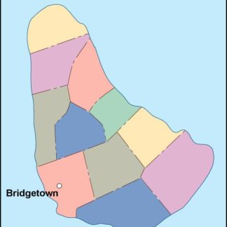
Barbados is a small island nation located in the eastern Caribbean Sea. It is situated in the Lesser Antilles, which is a chain of islands that stretches from the Virgin Islands in the north to Trinidad and Tobago in the south. The capital of Barbados is Bridgetown, which is located on the southwestern coast of the island.
The Barbados EPS map vector is a detailed representation of the island nation, featuring all of its major cities, towns, and landmarks. The map is designed to be used in a variety of applications, including tourism, education, and business.
The map is created using vector graphics, which means that it can be scaled to any size without losing its quality. This makes it ideal for use in large format printing, such as billboards and posters, as well as in digital applications, such as websites and mobile apps.
The map features a range of different elements, including roads, rivers, and mountains. The coastline of Barbados is also clearly defined, with all of the major beaches and bays marked out. The map also includes a range of different symbols and icons, such as airports, hospitals, and tourist attractions.
One of the key features of the Barbados EPS map vector is its level of detail. The map includes all of the major cities and towns on the island, as well as many of the smaller villages and settlements. This makes it an ideal tool for anyone looking to explore the island, whether they are a tourist or a local resident.
The map also includes a range of different layers, which can be turned on or off depending on the user’s needs. For example, the user can choose to display only the major roads and highways, or they can choose to display all of the smaller streets and lanes as well.
Overall, the Barbados EPS map vector is an essential tool for anyone looking to explore this beautiful island nation. Its high level of detail, versatility, and ease of use make it an ideal choice for a wide range of applications, from tourism and education to business and marketing.
Vector maps from Central America and Caribe Illustrator EPS files, fully editable from our American Country map database. All our digital cartography was created with Vector Adobe Illustrator
Once a map is paid we will send you our vector map:
-- via direct email and
-- a copy via Wetransfer
Delivery is usual in minutes from your order, but it can takes some hours in weekend.
From simplest maps to
the most detailed vector maps
——————————–
Illustrator, Freehand & Eps Files
Editable – Layer Structured
Worldwide delivery via email
Copyright Netmaps®, 1997-23
