Africa Climate Maps
Our collection of digital maps in Adobe Illustrator EPS format includes a wide range of maps for various countries and regions around the world. One of our most popular collections is our Africa Climate Maps, which provide detailed information on the climate patterns and weather conditions in different parts of the continent.
These maps are designed to be highly accurate and informative, with detailed information on temperature, rainfall, humidity, and other key climate indicators. They are ideal for use by researchers, educators, and anyone else who needs to understand the climate patterns and weather conditions in Africa.
In addition to climate maps, our collection also includes maps of major cities and regions in Africa, as well as political maps that show the borders and boundaries of different countries and territories. These maps are perfect for use in presentations, reports, and other types of visual media.
Overall, our collection of digital maps in Adobe Illustrator EPS format is an essential resource for anyone who needs accurate and detailed information on different parts of the world. Whether you are a researcher, educator, or business professional, our maps can help you better understand the geography, climate, and other key features of different regions and countries.
Showing 1–16 of 53 resultsSorted by latest
-

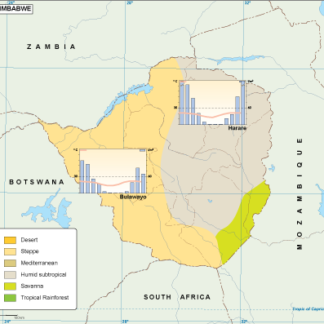
Zimbabwe climate eps map vector
65.00 € Select options -
Zambia climate eps map vector
65.00 € Select options -

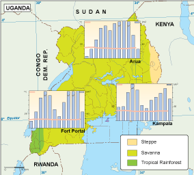
Uganda climate eps map vector
65.00 € Select options -

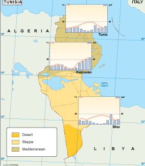
Tunisia climate eps map vector
65.00 € Select options -
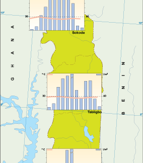
Togo climate eps map vector
65.00 € Select options -
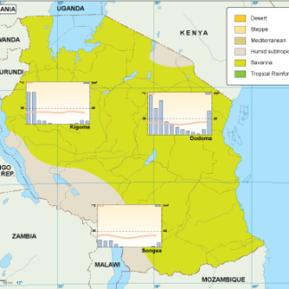
Tanzania climate eps map vector
65.00 € Select options -

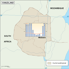
Swaziland climate eps map vector
65.00 € Select options -
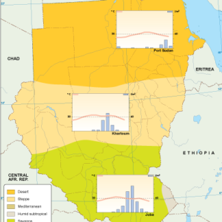
Sudan climate eps map vector
65.00 € Select options -
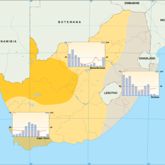
South Africa climate eps map vector
65.00 € Select options -
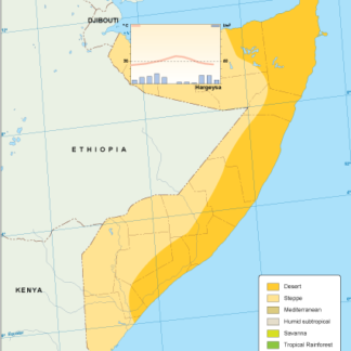
Somalia climate eps map vector
65.00 € Select options -
Sierra Leone climate eps map vector
65.00 € Select options -
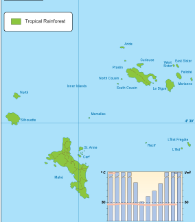
Seychelles climate eps map vector
65.00 € Select options -

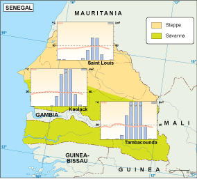
Senegal climate eps map vector
65.00 € Select options -
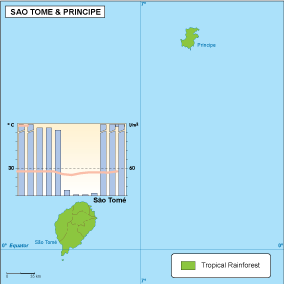
Sao Tome e Principe climate eps map vector
65.00 € Select options -

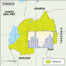
Rwanda climate eps map vector
65.00 € Select options -
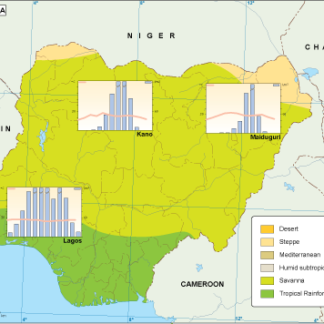
Nigeria climate eps map vector
65.00 € Select options


Showing 1–16 of 53 resultsSorted by latest