Europe Agricultural Maps
Our collection of digital maps in Adobe Illustrator EPS format includes a variety of maps for different countries, including Europe Agricultural Maps. These maps are designed to provide detailed information about the agricultural landscape of Europe, including the location of major cities and important agricultural regions.
Each map is created using high-quality vector graphics, which means that they can be scaled up or down without losing any of their detail or clarity. This makes them ideal for use in a wide range of applications, from print publications to digital media.
In addition to showing the location of major cities and agricultural regions, our Europe Agricultural Maps also include information about the types of crops grown in each region, as well as data on soil types, climate, and other factors that can affect agricultural production.
Whether you are a farmer, a researcher, or simply someone who is interested in learning more about the agricultural landscape of Europe, our collection of digital maps in Adobe Illustrator EPS format is an invaluable resource. So why not explore our collection today and discover all that these maps have to offer?
Showing 1–16 of 22 resultsSorted by latest
-

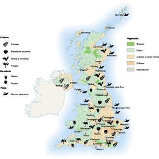
United Kingdom Agricultural eps map vector
70.00 € Select options -
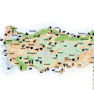
Turkey Agricultural eps map vector
70.00 € Select options -
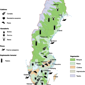
Sweden Agricultural eps map vector
70.00 € Select options -
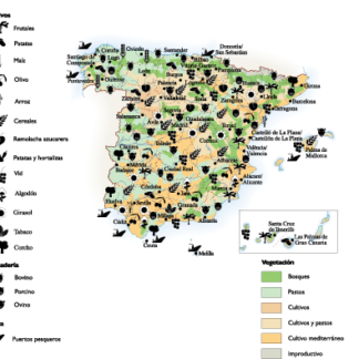
Spain Agricultural eps map vector
70.00 € Select options -

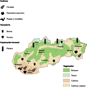
Slovak Republic Agricultural eps map vector
70.00 € Select options -
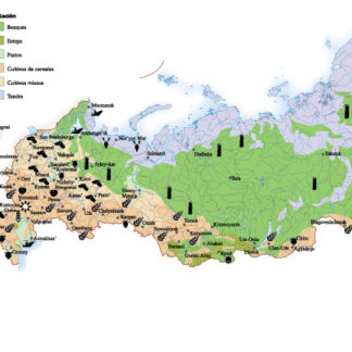
Russia Agricultural eps map vector
70.00 € Select options -
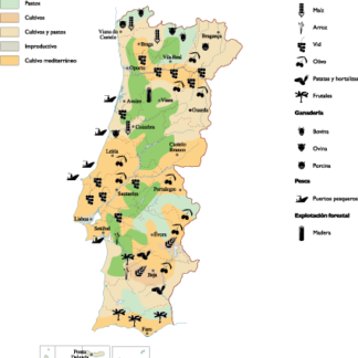
Portugal Agricultural eps map vector
70.00 € Select options -
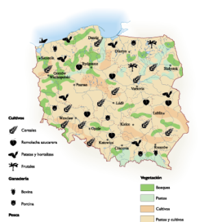
Poland Agricultural eps map vector
70.00 € Select options -
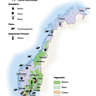
Norway Agricultural eps map vector
70.00 € Select options -
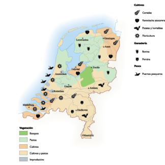
Netherlands Agricultural eps map vector
70.00 € Select options -
Ireland Agricultural eps map vector
70.00 € Select options -
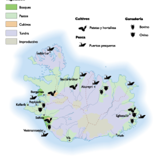
Iceland Agricultural eps map vector
70.00 € Select options -

Greece Agricultural eps map vector
70.00 € Select options -
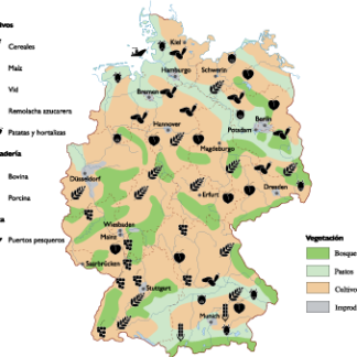
Germany Agricultural eps map vector
70.00 € Select options -
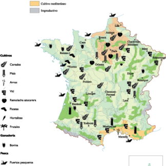
France Agricultural eps map vector
70.00 € Select options -
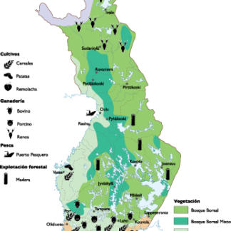
Finland Agricultural eps map vector
70.00 € Select options


Showing 1–16 of 22 resultsSorted by latest