Guatemala city eps map vector
65.00 €
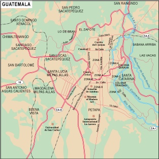
The Guatemala City EPS map vector available on epsmaps.com is a high-quality map designed for professional use. It is created using Adobe Illustrator, making it a vector format that can be easily scaled up or down without losing any quality.
Located in the heart of Guatemala, Guatemala City is the capital and largest city in the country. The city is situated in the southern part of Central America, bordered by Mexico to the north and west, Belize to the northeast, Honduras to the east, and El Salvador to the southeast.
The Guatemala City EPS map vector includes all of the major streets and landmarks in the city, making it an essential tool for businesses and professionals who need to navigate the area. Some of the main streets highlighted on the map include Avenida Reforma, Avenida Las Americas, and Avenida Petapa.
In addition to the streets, the map also includes important landmarks such as the National Palace, the Metropolitan Cathedral, and the National Museum of Archaeology and Ethnology. With its detailed and accurate information, the Guatemala City EPS map vector is an invaluable resource for anyone doing business in the city.


