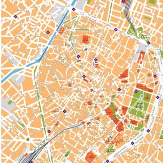
At EPSMaps.com, we prioritize the sale of digital maps in EPS and Illustrator vector formats to businesses and professionals. Our maps are designed to provide accurate and detailed information about cities across the world. In this article, we will describe the city of Brussels, its location in Belgium, and the main streets of the city.
Brussels is the capital city of Belgium and is located in the central part of the country. It is a vibrant and cosmopolitan city that is home to the European Union headquarters and NATO. The city has a population of over 1.2 million people and is known for its stunning architecture, delicious cuisine, and rich history.
One of the main attractions of Brussels is the Grand Place, which is a UNESCO World Heritage Site. The Grand Place is a beautiful square that is surrounded by stunning buildings, including the Town Hall and the Breadhouse. The square is also home to many cafes and restaurants, making it a popular spot for tourists and locals alike.
Another popular attraction in Brussels is the Atomium, which is a unique building that was built for the 1958 World Expo. The Atomium is a giant steel structure that is shaped like an atom and offers stunning views of the city from its observation deck.
When it comes to the main streets of Brussels, there are several that are worth mentioning. The Rue Neuve is one of the busiest shopping streets in the city and is home to many popular stores and boutiques. The Avenue Louise is another popular street that is known for its high-end shops and luxury boutiques.
The Rue des Bouchers is a famous street in Brussels that is known for its many restaurants and cafes. This street is a popular spot for tourists and locals alike, and it offers a wide range of cuisine options, including traditional Belgian dishes like moules-frites (mussels and fries).
In conclusion, Brussels is a beautiful and vibrant city that is full of history, culture, and delicious food. Our digital maps in EPS and Illustrator vector formats provide accurate and detailed information about the city, including its main streets and attractions. If you are a business or professional looking for high-quality digital maps, be sure to check out EPSMaps.com.


