Description
cambodja vector map. Vector maps from Asia. Illustrator EPS files, fully editable from our Asian Country map database. All our digital cartography was created with Vector Adobe Illustrator
Vector eps City maps of the cities and countries of the world. More than 10 000 vector files
39.00 €
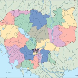
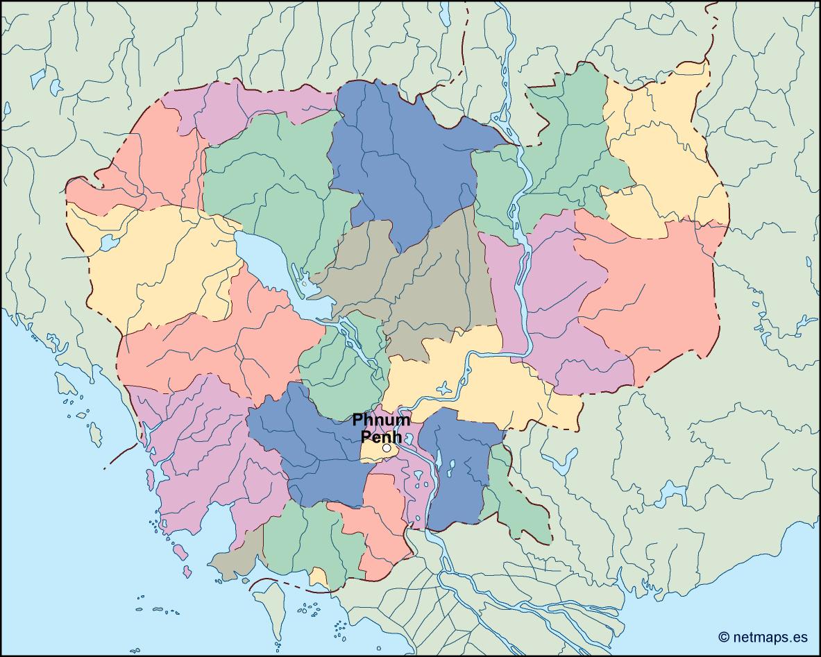
Cambodia is a Southeast Asian country that is located in the southern part of the Indochina Peninsula. It is bordered by Thailand to the northwest, Laos to the northeast, Vietnam to the east, and the Gulf of Thailand to the southwest. The capital city of Cambodia is Phnom Penh, which is located in the southern part of the country.
The Cambodia EPS map vector is a detailed representation of the country’s geography, including its provinces, cities, and major landmarks. The map is designed to be used in a variety of applications, including tourism, education, and business.
The map is created using vector graphics, which means that it can be scaled to any size without losing its quality. This makes it ideal for use in large format printing, such as billboards and posters. The map is also compatible with a variety of software programs, including Adobe Illustrator and CorelDRAW.
The Cambodia EPS map vector includes all of the country’s provinces, which are color-coded for easy identification. The provinces are labeled with their names, and their boundaries are clearly defined. The map also includes major cities, such as Phnom Penh, Siem Reap, and Battambang, as well as smaller towns and villages.
In addition to the provinces and cities, the Cambodia EPS map vector also includes major landmarks and tourist attractions. These include the Angkor Wat temple complex, the Tonle Sap lake, and the Mekong River. The map also includes national parks and wildlife reserves, such as the Cardamom Mountains and the Preah Vihear Temple.
The map is designed to be easy to read and understand, with clear labeling and a simple color scheme. The land areas are shaded in a light green color, while the water areas are shaded in blue. The major roads and highways are labeled with their names and are color-coded for easy identification.
Overall, the Cambodia EPS map vector is an essential tool for anyone who needs to navigate the country’s geography. Whether you are a tourist, a business owner, or a student, this map will provide you with the information you need to explore Cambodia and its many attractions.
cambodja vector map. Vector maps from Asia. Illustrator EPS files, fully editable from our Asian Country map database. All our digital cartography was created with Vector Adobe Illustrator