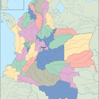
Description
colombia vector map. Vector maps from Latin South America. Illustrator EPS files, fully editable from our American Country map database. All our digital cartography was created with Vector Adobe Illustrator
Vector eps City maps of the cities and countries of the world. More than 10 000 vector files
39.00 €
illustrator for sale
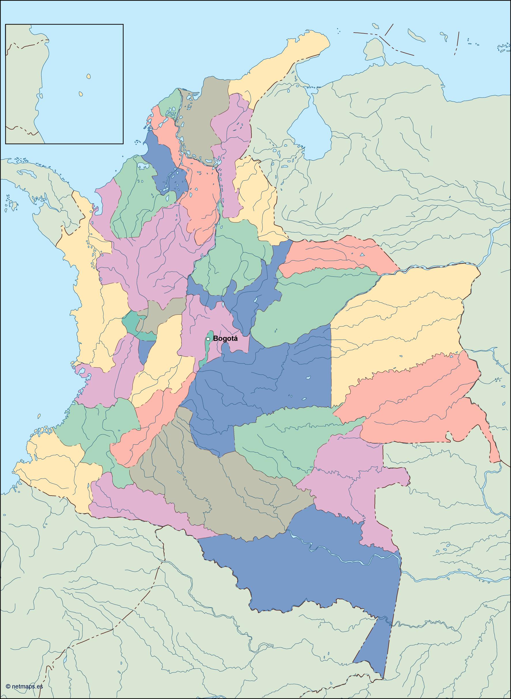
Colombia is a country located in the northwestern region of South America. It is bordered by Venezuela to the east, Brazil to the southeast, Peru and Ecuador to the south, Panama to the northwest, and the Caribbean Sea to the north. The capital of Colombia is Bogotá, which is located in the central region of the country.
The EPS vector illustrator map of Colombia for sale is a detailed and accurate representation of the country’s geography. The map includes all of the major cities, towns, and landmarks, as well as the country’s borders and surrounding bodies of water. The map is designed to be used for a variety of purposes, including educational materials, travel guides, and business presentations.
The map is created using vector graphics, which means that it can be scaled to any size without losing quality. This makes it ideal for use in print materials, such as brochures and posters, as well as digital media, such as websites and mobile apps. The map is also fully editable, allowing users to customize it to their specific needs.
The map includes a range of features that make it easy to use and understand. The country’s borders are clearly defined, and each region is color-coded for easy identification. Major cities are labeled with their names and population sizes, and important landmarks, such as national parks and historical sites, are also marked.
In addition to the main map of Colombia, the EPS vector illustrator file also includes a range of additional elements that can be used to enhance the map. These include icons for transportation, such as airports and train stations, as well as symbols for tourist attractions, such as museums and beaches.
Overall, the EPS vector illustrator map of Colombia for sale is an essential tool for anyone looking to explore or do business in this vibrant and diverse country. With its detailed and accurate representation of the country’s geography, it is the perfect resource for travel guides, educational materials, and business presentations. So, if you are looking for a high-quality map of Colombia, look no further than this EPS vector illustrator file.
colombia vector map. Vector maps from Latin South America. Illustrator EPS files, fully editable from our American Country map database. All our digital cartography was created with Vector Adobe Illustrator