Description
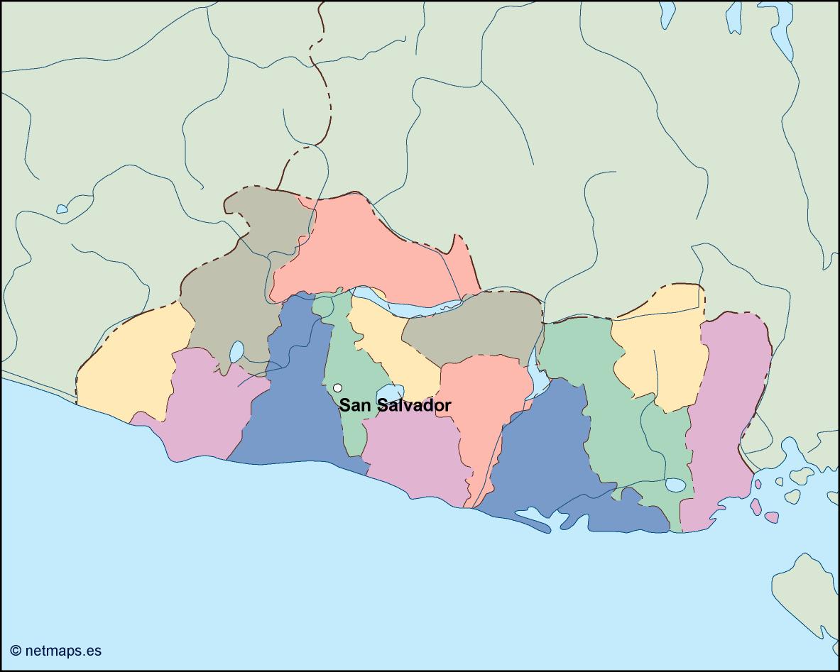
el salvador vector map. Vector maps from Central America and Caribe Illustrator EPS files, fully editable from our American Country map database. All our digital cartography was created with Vector Adobe Illustrator
Vector eps City maps of the cities and countries of the world. More than 10 000 vector files
39.00 €
The El Salvador EPS map vector is a detailed and accurate representation of the Central American country of El Salvador. The map is designed to be used in a variety of applications, including print and digital media, and is available in a range of formats, including Adobe Illustrator EPS.
El Salvador is a small country located in Central America, bordered by Guatemala to the west, Honduras to the north and east, and the Pacific Ocean to the south. The country has a total area of 21,041 square kilometers and a population of approximately 6.5 million people. The capital city of El Salvador is San Salvador, which is located in the central part of the country.
The El Salvador EPS map vector is designed to be easy to use and highly customizable. The map is divided into different layers, which can be easily edited and customized to suit the needs of the user. The layers include the country border, major cities, rivers, lakes, and other geographical features.
The map also includes a range of useful information, including the location of major highways and roads, airports, and other important landmarks. This information is presented in a clear and easy-to-understand format, making it easy for users to navigate and find their way around the country.
One of the key features of the El Salvador EPS map vector is its high level of detail. The map includes a range of geographical features, including mountains, valleys, and coastal regions. This level of detail makes the map ideal for a range of applications, including tourism, education, and business.
The El Salvador EPS map vector is also designed to be highly scalable. This means that the map can be easily resized without losing any of its detail or clarity. This makes it ideal for use in a range of different applications, from small print materials to large-scale digital displays.
Overall, the El Salvador EPS map vector is an essential tool for anyone looking to explore or do business in this fascinating Central American country. With its high level of detail, ease of use, and scalability, the map is an invaluable resource for anyone looking to navigate the country’s diverse and beautiful landscape.
el salvador vector map. Vector maps from Central America and Caribe Illustrator EPS files, fully editable from our American Country map database. All our digital cartography was created with Vector Adobe Illustrator