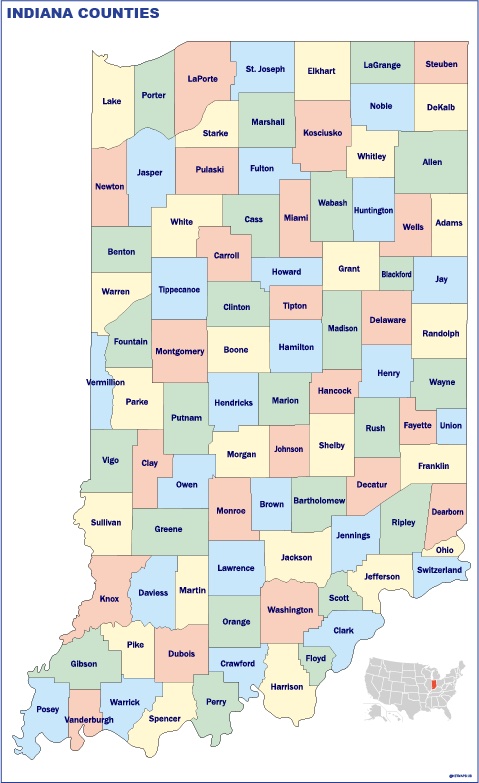
Indiana counties

49.00 

Indiana counties vector map

Digital file

Our original maps are vector files, but we can export them to other formats as PDF or JPF high resolution (200 dpi). You just need to choose your option below.

Map is sent as Adobe Illustrator file. All information is fully editable

Map is sent as Adobe Illustrator file. All information is fully editable

Map is exported to a pdf file. Pdf can be imported directly as a vector file

Map is exported to a pdf file. Pdf can be imported directly as a vector file

Map is exported to a raster image, 200 dpi. Jpg file is delivered. It is our cheaper option, but maybe is enough for your project.

Map is exported to a raster image, 200 dpi. Jpg file is delivered. It is our cheaper option, but maybe is enough for your project.

Product price:49.00 
Total options:
Order total:
SKU: Indiana counties vector map Category: Tags: ,

Description

Indiana counties eps map. Counties serve as administrative divisions within states and are primarily responsible for local governance. They play a crucial role in delivering essential public services, such as law enforcement, public education, public health, and infrastructure development. The creation and organization of counties are determined by state laws, and each state may have its own unique system.