Description
liverpool vector map
Vector eps City maps of the cities and countries of the world. More than 10 000 vector files
895.00 €
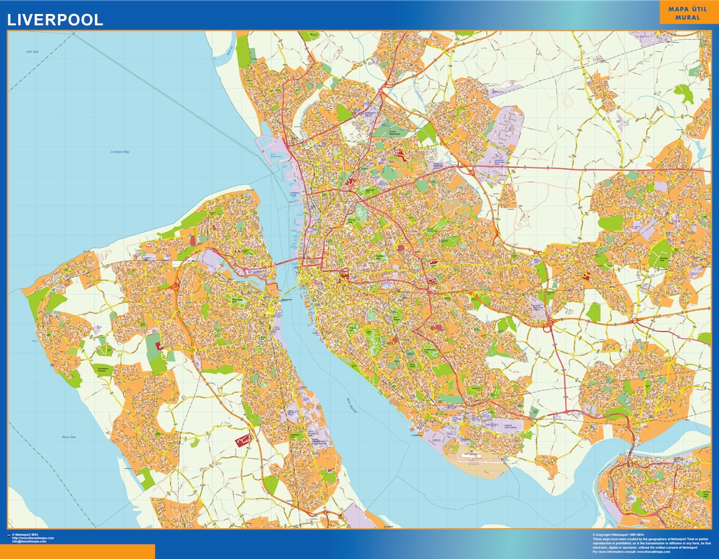
The Liverpool EPS map vector is a detailed representation of the city, highlighting its main streets and parks. Located in the northwest of England, Liverpool is a major port city and a cultural hub. The map shows the River Mersey, which runs through the city and connects it to the Irish Sea.
Some of the main streets highlighted on the map include Lime Street, which is home to the city’s main train station, and Hope Street, which is known for its historic architecture and cultural institutions. Other notable streets include Bold Street, which is lined with independent shops and restaurants, and Mathew Street, which is famous for its association with The Beatles.
The map also highlights some of Liverpool’s main parks, including Sefton Park and Stanley Park. Sefton Park is a large public park with a boating lake, while Stanley Park is home to a number of sports facilities and a popular walking trail.
Overall, the Liverpool EPS map vector provides a comprehensive overview of the city’s layout and key landmarks, making it a useful tool for both locals and visitors alike.
liverpool vector map