Description
mapa vectorial alicante. EPS Vector maps of Cities of Spain. The largest database of Spanish City Maps. Mapas Vectoriales Ciudades España en formato Illustrator. Archivos .ai y .eps
Vector eps City maps of the cities and countries of the world. More than 10 000 vector files
795.00 €
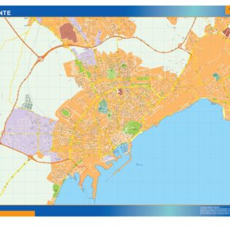
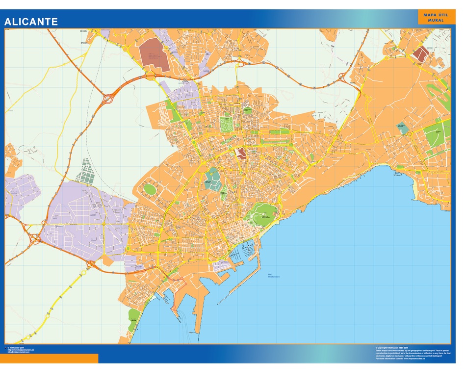
The EPS vector map of Alicante city highlights its main streets and parks, as well as its location in Spain. The map shows the city’s central area, including the historic Old Town and the modern commercial district. The main streets, such as Avenida de Alfonso X el Sabio and Avenida de Maisonnave, are clearly marked, along with the major parks, such as El Palmeral and Lo Morant. The map also shows the location of the city’s main landmarks, such as the Castle of Santa Barbara and the Basilica of Santa Maria. Overall, the EPS vector map of Alicante provides a detailed and accurate representation of the city’s layout and features.
mapa vectorial alicante. EPS Vector maps of Cities of Spain. The largest database of Spanish City Maps. Mapas Vectoriales Ciudades España en formato Illustrator. Archivos .ai y .eps