Description
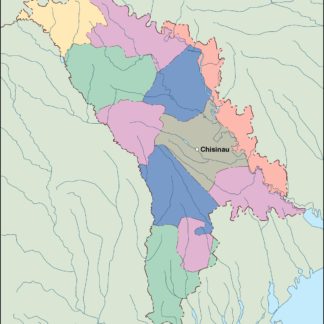
moldova vector map. Vector maps from Europe. Illustrator EPS files, fully editable from our european Country map database. All our digital cartography was created with Vector Adobe Illustrator
Vector eps City maps of the cities and countries of the world. More than 10 000 vector files
39.00 €
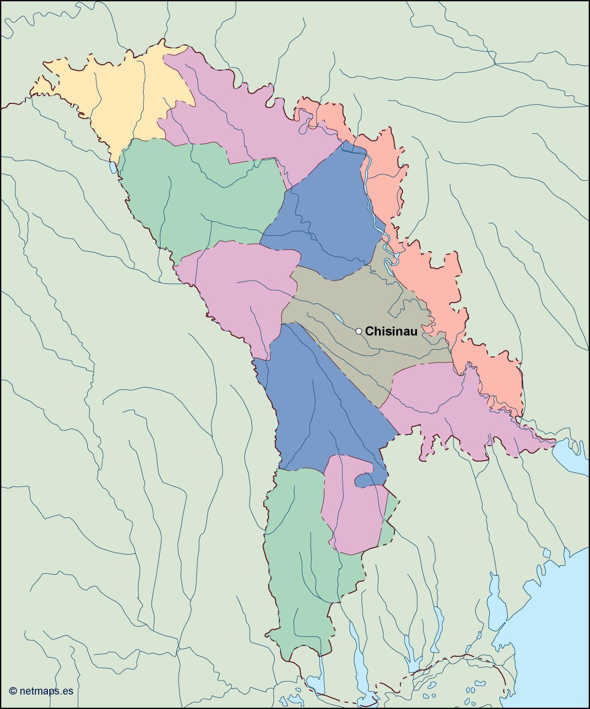
Moldova is a small landlocked country located in Eastern Europe. It is bordered by Romania to the west and Ukraine to the north, east, and south. The capital of Moldova is Chisinau, which is located in the central part of the country.
The Moldova EPS map vector is a detailed representation of the country’s geography, including its major cities, rivers, and other important landmarks. The map is designed to be used in a variety of applications, including print and digital media, and is available in a range of formats to suit different needs.
The Moldova EPS map vector is created using Adobe Illustrator, a powerful vector graphics software that allows for precise and scalable designs. The map is created using a combination of vector shapes, lines, and text, which can be easily edited and customized to suit specific requirements.
The map includes all of the major cities in Moldova, including Chisinau, Balti, Tiraspol, and Bender. Each city is represented by a unique symbol, which makes it easy to identify and locate on the map. The map also includes the major rivers in Moldova, including the Dniester and Prut rivers, which are important for transportation and agriculture.
In addition to the cities and rivers, the Moldova EPS map vector also includes other important landmarks, such as national parks, mountains, and historical sites. These landmarks are represented by unique symbols, which make them easy to identify and locate on the map.
The Moldova EPS map vector is designed to be used in a variety of applications, including print and digital media. It is available in a range of formats, including EPS, AI, PDF, and SVG, which makes it easy to use in different software applications. The map is also available in different sizes and resolutions, which makes it suitable for different types of projects.
Overall, the Moldova EPS map vector is a valuable tool for anyone who needs to create maps or visualizations of Moldova. Its detailed and accurate representation of the country’s geography makes it an essential resource for businesses, government agencies, and individuals who need to work with Moldova’s geography and location.
moldova vector map. Vector maps from Europe. Illustrator EPS files, fully editable from our european Country map database. All our digital cartography was created with Vector Adobe Illustrator