Description
nigeria vector map. Vector maps from Africa. Illustrator EPS files, fully editable from our African map database. All our digital cartography was created with Vector Adobe Illustrator
Vector eps City maps of the cities and countries of the world. More than 10 000 vector files
39.00 €
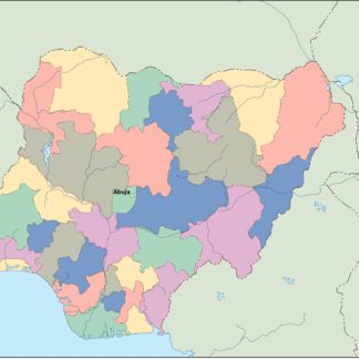
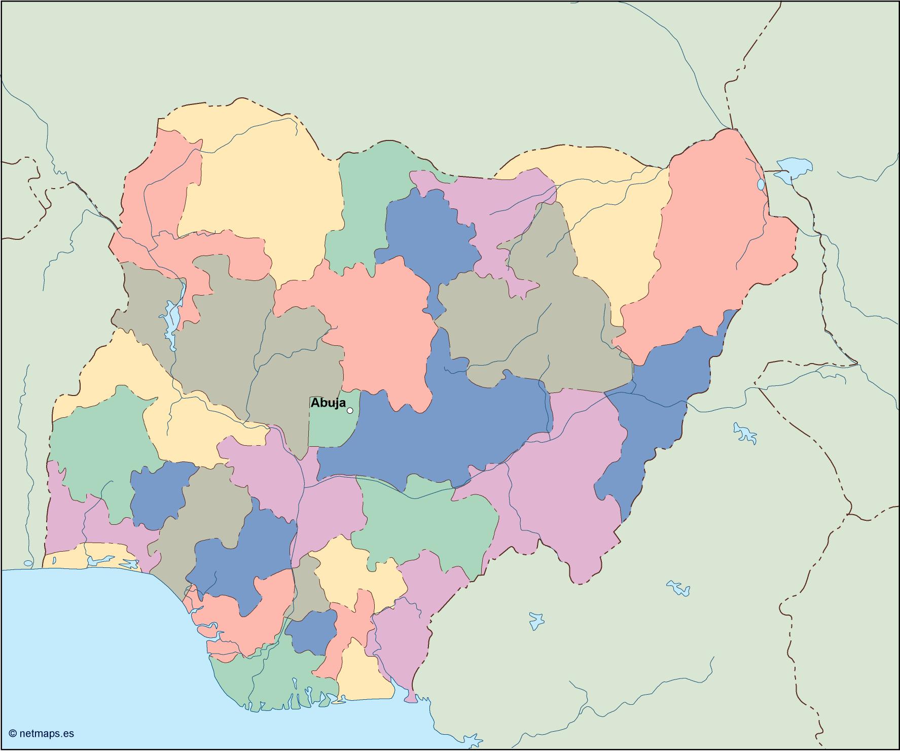
Nigeria is a country located in West Africa. It is the most populous country in Africa and the seventh most populous country in the world. The country is bordered by Niger to the north, Chad to the northeast, Cameroon to the east, and Benin to the west. Its southern coast is on the Gulf of Guinea in the Atlantic Ocean. The capital of Nigeria is Abuja, which is located in the center of the country.
The Nigeria EPS map vector is a detailed representation of the country’s geography, including its states, cities, and major landmarks. The map is designed in a way that makes it easy to navigate and understand, with clear labels and symbols that indicate important features.
The map is divided into six geopolitical zones, which are North West, North East, North Central, South West, South East, and South South. Each zone is color-coded for easy identification, and the states within each zone are clearly labeled. The map also includes major cities such as Lagos, Kano, Ibadan, and Port Harcourt, as well as rivers such as the Niger and Benue.
One of the most prominent features of the Nigeria EPS map vector is the location of the country within its continent. Nigeria is located in West Africa, bordered by the Atlantic Ocean to the south and west. The country is situated between latitudes 4° and 14°N, and longitudes 2° and 15°E. The map clearly shows Nigeria’s position in relation to other countries in West Africa, such as Ghana, Togo, and Cameroon.
The Nigeria EPS map vector is designed to be used in a variety of contexts, including educational materials, business presentations, and tourism guides. The map is available in a range of formats, including PDF, EPS, and AI, making it easy to use in a variety of design software.
Overall, the Nigeria EPS map vector is an essential tool for anyone looking to explore or do business in Nigeria. Its detailed and accurate representation of the country’s geography makes it an invaluable resource for anyone looking to navigate Nigeria’s complex landscape. Whether you’re a student, a businessperson, or a tourist, the Nigeria EPS map vector is an essential tool for understanding and exploring this fascinating country.
nigeria vector map. Vector maps from Africa. Illustrator EPS files, fully editable from our African map database. All our digital cartography was created with Vector Adobe Illustrator