Description
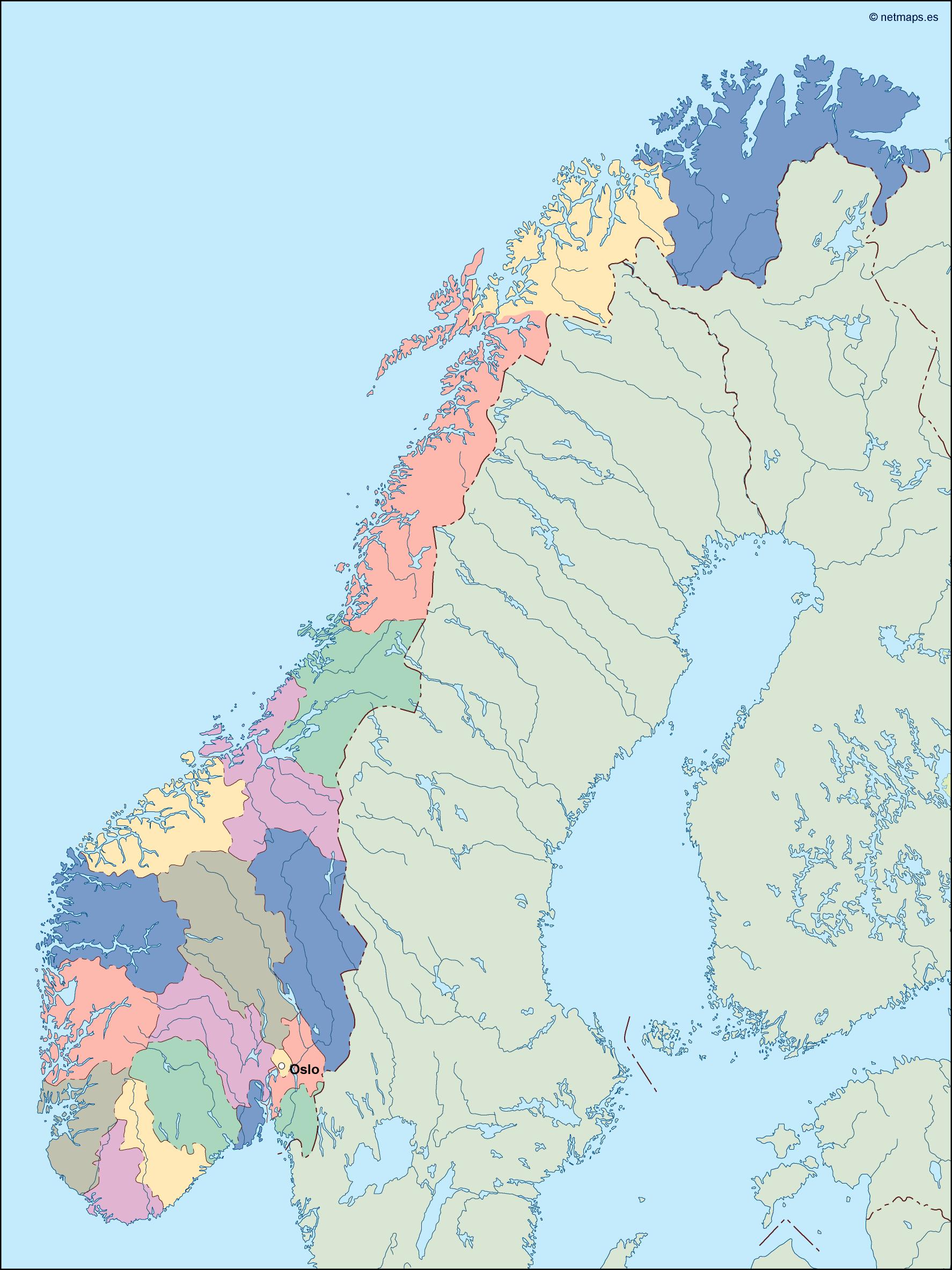
norway vector map. Vector maps from Europe. Illustrator EPS files, fully editable from our european Country map database. All our digital cartography was created with Vector Adobe Illustrator
Vector eps City maps of the cities and countries of the world. More than 10 000 vector files
39.00 €
illustrator for sale
Norway is a country located in Northern Europe, bordered by Sweden, Finland, and Russia to the east, and the North Sea and the Norwegian Sea to the west. The country has a population of approximately 5.4 million people and covers an area of 385,207 square kilometers. The capital of Norway is Oslo, which is located in the southeastern part of the country.
The Norway EPS map vector illustrator for sale is a high-quality map that is perfect for use in a variety of applications. The map is designed to be used in Adobe Illustrator, and it is available in both EPS and AI formats. The map is fully editable, which means that you can customize it to suit your needs.
The map features a detailed outline of Norway, including all of its major cities and towns. The map also includes the country’s major rivers, lakes, and mountain ranges. The map is designed to be easy to read and understand, with clear labels and symbols that make it easy to identify different features of the landscape.
One of the key features of the Norway EPS map vector illustrator for sale is its accuracy. The map is based on the latest data from the Norwegian government, which means that it is up-to-date and reliable. This makes it an ideal tool for anyone who needs to work with accurate geographic data.
Another important feature of the Norway EPS map vector illustrator for sale is its versatility. The map can be used in a variety of applications, including print and digital media. It is perfect for use in brochures, posters, and other marketing materials, as well as in websites and mobile apps.
Overall, the Norway EPS map vector illustrator for sale is an excellent tool for anyone who needs to work with accurate geographic data. Whether you are a marketer, a designer, or a developer, this map is sure to be a valuable addition to your toolkit. So why wait? Get your copy today and start exploring the beauty of Norway!
norway vector map. Vector maps from Europe. Illustrator EPS files, fully editable from our european Country map database. All our digital cartography was created with Vector Adobe Illustrator