Description
Stavanger kart. Norway Vector Kart. EPS Illustrator maps Norway Cities
Vector eps City maps of the cities and countries of the world. More than 10 000 vector files
795.00 €
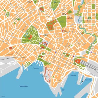
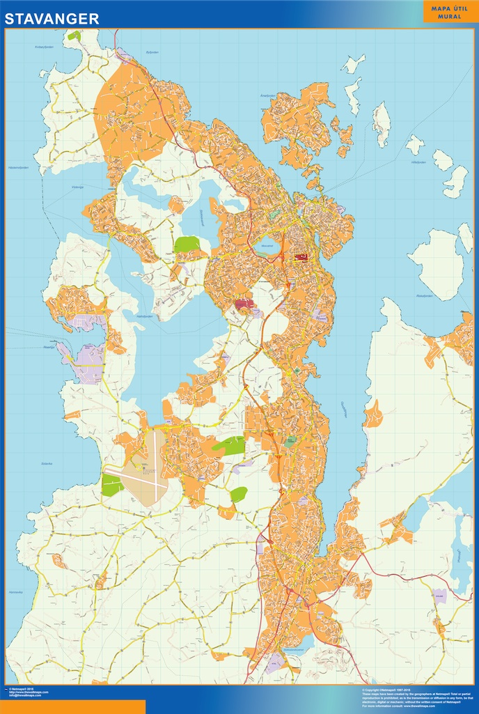
The Stavanger EPS Illustrator vector map depicts the city of Stavanger, located in Norway. The map highlights the main streets and parks of the city, providing a comprehensive overview of its layout and landmarks.
Some of the main streets featured on the map include Kongsgata, Kirkegata, and Strandkaien, which run through the heart of the city and connect it to the surrounding areas. The map also highlights several major parks, including Breiavatnet Park and Stokkavannet Park, which provide green spaces for residents and visitors to enjoy.
Overall, the Stavanger EPS Illustrator vector map is a useful tool for anyone looking to explore the city and its surroundings. Its detailed depiction of the city’s streets and parks makes it easy to navigate, while its clear labeling and color-coding help users quickly identify key landmarks and points of interest.
Stavanger kart. Norway Vector Kart. EPS Illustrator maps Norway Cities