Description
surinam vector map. Vector maps from Central America and Caribe Illustrator EPS files, fully editable from our American Country map database. All our digital cartography was created with Vector Adobe Illustrator
Vector eps City maps of the cities and countries of the world. More than 10 000 vector files
39.00 €
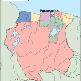
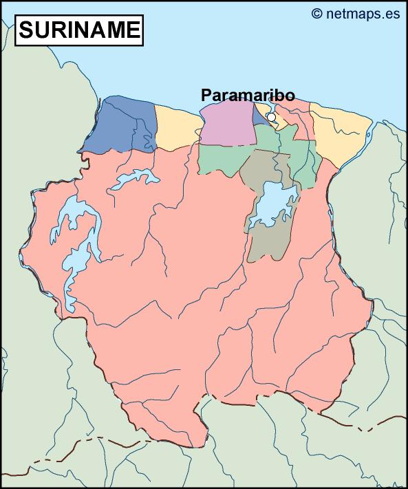
Suriname is a small country located in the northeastern region of South America. It is bordered by Guyana to the west, French Guiana to the east, Brazil to the south, and the Atlantic Ocean to the north. The capital of Suriname is Paramaribo, which is located on the northern coast of the country.
The Suriname EPS map vector is a detailed representation of the country’s geography, including its rivers, mountains, and major cities. The map is designed to be used for a variety of purposes, including educational materials, tourism guides, and business presentations.
The map is created using vector graphics, which means that it can be scaled to any size without losing its quality. This makes it ideal for use in print materials, such as brochures and posters, as well as digital media, such as websites and mobile apps.
The map includes all of the major cities and towns in Suriname, including Paramaribo, Nieuw Nickerie, Moengo, and Albina. Each city is labeled with its name and is represented by a small dot on the map. The map also includes the country’s major rivers, including the Suriname River, the Maroni River, and the Coppename River.
In addition to the cities and rivers, the map also includes the country’s major mountain ranges, including the Wilhelmina Mountains and the Van Asch Van Wijck Mountains. These mountain ranges are represented by shaded areas on the map, which help to give the viewer a sense of the country’s topography.
The Suriname EPS map vector also includes a number of other features that are useful for anyone looking to learn more about the country. For example, the map includes a scale bar, which allows the viewer to determine the distance between different points on the map. The map also includes a compass rose, which indicates the direction of north, south, east, and west.
Overall, the Suriname EPS map vector is an excellent resource for anyone looking to learn more about this fascinating country. Whether you are a student, a tourist, or a business professional, this map is sure to provide you with the information you need to better understand Suriname and its place in the world.
surinam vector map. Vector maps from Central America and Caribe Illustrator EPS files, fully editable from our American Country map database. All our digital cartography was created with Vector Adobe Illustrator